search
Autobahn Germany map
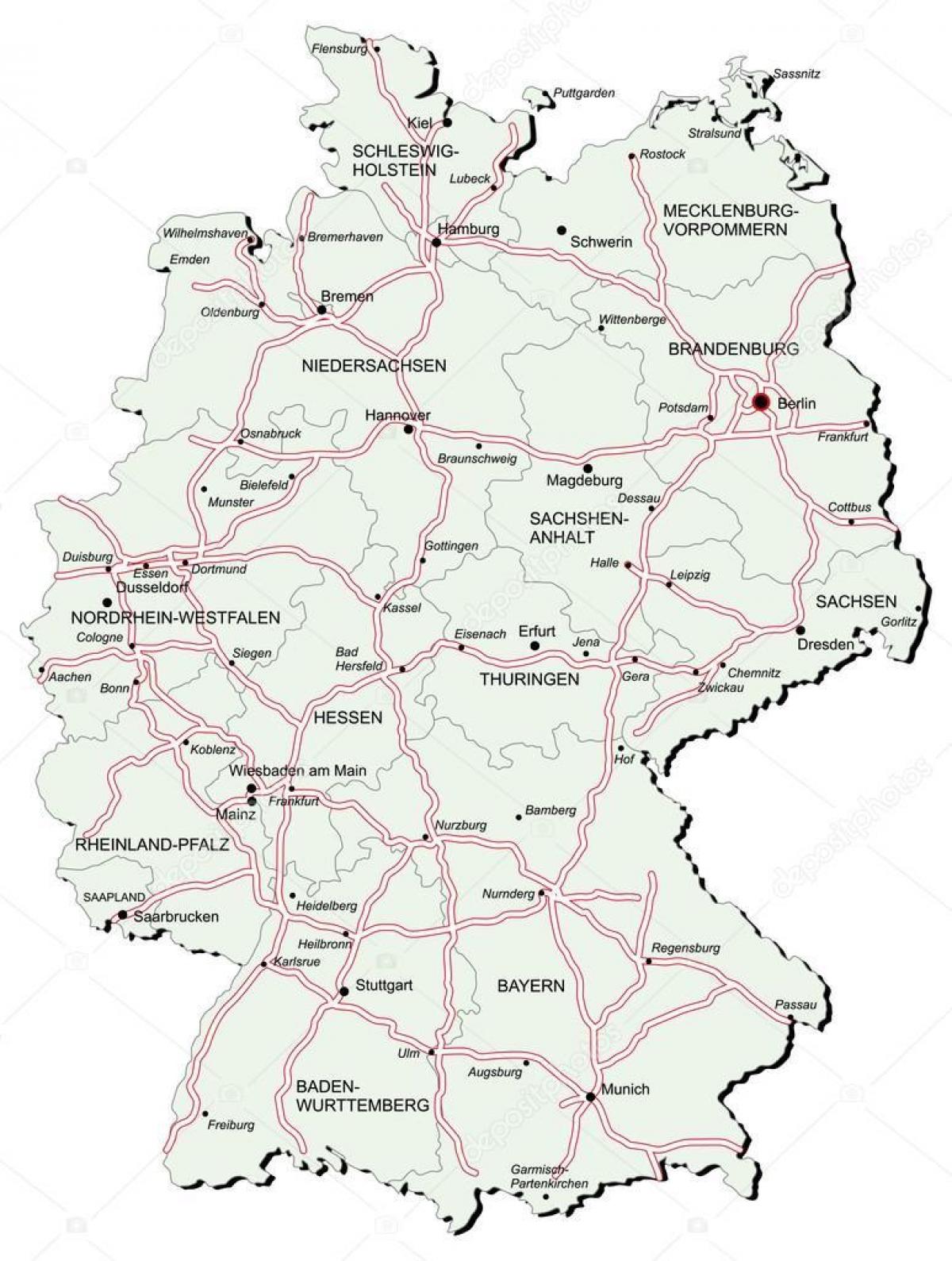
Germany autobahn map. Autobahn Germany map (Western Europe - Europe) to print. Autobahn Germany map (Western Europe - Europe) to download. Autobahn is the German word for a major high-speed road restricted to motor vehicles capable of driving at least 60 km/h (37 mph) and having full control of access, similar to a motorway or freeway in English-speaking countries. The advisory speed limit (Richtgeschwindigkeit) of the German autobahn is 130 km/h (80 mph), but there is no general speed limit. Austrian and Swiss autobahns have general speed limits of 130 km/h (80 mph) and 120 km/h (75 mph), respectively as its shown in autobahn Germany map. The official name of the autobahn in Germany is Bundesautobahn (BAB) (Federal Motorway). Autobahns are built and maintained by the federal government (as are the federal highways), thus the name "Federal Motorway". The first were built in the 1920s, and in the 1930s the official name was "Reichsautobahn" (freeway of the Reich).
Just like all European highways, autobahns have multiple lanes of traffic in each direction like a dual carriage way, separated by a central barrier with grade-separated junctions and access restricted to certain types of motor vehicles only. The first road of this kind was completed in 1931 between Cologne and Bonn and opened by Konrad Adenauer (Lord Mayor of Cologne and future Chancellor of West Germany) on 6 August, 1932. This road was not yet called Autobahn, but instead was known as a Kraftfahrtstraße (lit. automobile road) as its mentioned in autobahn Germany map. The idea was a street which had no crossings and was only to be used by cars and motorcycles and not by pedestrians or the common horse drawn carts. As Adolf Hitler did not become Chancellor until afterwards in January 1933, the claim that the Autobahn was conceived by the Nazis is a myth.
All Autobahns are named by using the capital letter A followed by a space and a number (for example A 8). The "main autobahns" going all across Germany have a single digit number usually even-numbered for east-west routes and odd-numbered for north-south routes; an exception being the A 3, part of which is east-west parallel to the A 8. Shorter autobahns that are of regional importance (e.g. connecting two major cities or regions within Germany) have a double digit number (e.g. A 24, connecting Berlin and Hamburg) as you can see in autobahn Germany map. There are also very short autobahns, of local importance (such as beltways, or the A 555 from Cologne to Bonn). Their numbers usually have three digits, the first one of which is similar to the system above, depending on the region.
The German autobahns are famous for being some of the few public roads in the world without blanket speed limits for cars and motorcycles. Certainly, speed limits do apply at junctions and other danger points, like sections under construction or in need of repair. Speed limits at non-construction sites are typically 100 km/h, 120 km/h, or 130 km/h, on the A2 are also parts with a 140 km/h speed limit as its shown in autobahn Germany map. Construction sites have a usual speed limit of 80 km/h but may be as low as 60 km/h. Vehicles unable to attain speeds in excess of 60 km/h are not allowed to use the autobahn. Though this limit is not high for most modern vehicles, it prevents very small cars (e.g. Quads) and motor-scooters (e.g. mopeds) from using autobahns. To comply with this limit, several heavy-duty trucks (e.g. for carrying heavy equipment) have a design speed of 62 km/h (usually denoted by a round black-on-white sign with "62" on it).


